AERIAL IMAGING: A GAME CHANGER IN CROP MANAGEMENT EFFICIENCY
Key points
- Aerial imaging is becoming more essential as farm sizes grow and precision increases.
- The technology helps farmers be more efficient and effective with scouting.
- A support team is critical to unlocking the full value of the tool.
Aerial imaging via agriculture drones or airplanes outfitted with cameras might be one of the most underutilized tools in agriculture. Cost, uneasiness with the technology and misconceptions about the tools’ capabilities have limited their adoption.
“There’s a lot of skepticism with aerial imagery because farmers think it’s simply pictures,” says AgriGold Agronomist Brett Leahr. “But once farmers bring in someone who knows these tools to work with them, that’s when the real value comes in.”
As farm sizes increase and farmers work to capture every bushel, Leahr expects aerial imaging tools will become increasingly essential to the farmer toolbox.
Major efficiencies in scouting
“If you farm at a large scale, you simply can’t be everywhere to look at everything,” says Brian Rinderer, a farmer in Illinois. But aerial imaging can help farmers monitor fields 24/7 in addition to guiding their in-field scouting.
“I can use aerial imaging to send an agronomist right to my problem fields or even down to my problem acres,” Rinderer says. That makes scouting much more efficient and effective for Rinderer and his support team.
The technology should be a supplement to scouting, not a replacement. Results still need to be ground-truthed. But aerial imaging can help farmers be more vigilant, catch more issues in real time and be more precise with solutions, which can reduce costs.
“There’s no hiding mistakes with this,” Rinderer says. In fact, he says one of the biggest surprises with the technology, in his experience, has been the accuracy of its yield-monitoring projections. If he had trusted the system’s corn yield predictions in 2023, Rinderer says he could have been far more profitable marketing his crop.
Investing in aerial imaging has paid off for Rinderer — in efficiency and predictability. “If there are standability issues with a corn hybrid, I can see that ahead of time and plan to take that field out early,” Rinderer offers as an example. “Or I could address anhydrous application issues before the crop is too far along.”

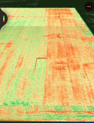
This NDVI map shows that corn’s vegetative growth was hindered by a farmer turning off his liquid system for the rows on the right side of this field.
Wide-ranging applications
The capabilities of today’s aerial imaging might surprise some farmers. Some of its applications include using Normalized Difference Vegetation Index (NDVI) imagery to identify problem areas, conducting stand counts and producing topography maps.
In practice, these systems may send a notification that the back forty had less than desired populations. That would alert a farmer of the need to check that field and consider whether a replant is warranted.
NDVI imagery is remarkably clear — so clear that one farmer could easily identify a spreader issue that reduced plant material, Leahr shares. That heads-up and subsequent field check led to equipment adjustments and avoidance of additional losses the following growing season.
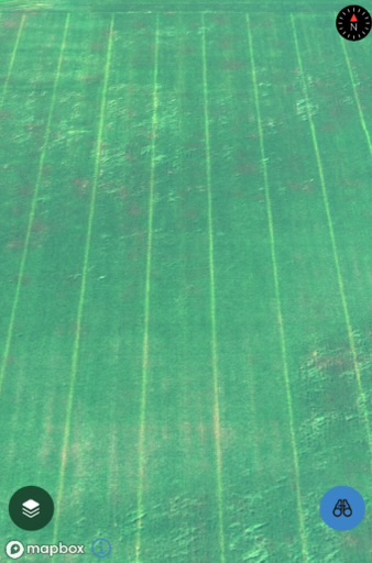
He says another farmer could see clear evidence of skips due to a plugged knife on a toolbar. “We can see exactly where the knife got plugged,” Leahr explains. “We calculated how many acres of loss were likely based on that skip and adjusted marketing strategies accordingly.”

The lime green strips reflect a plugged knife on a toolbar. Wind damage is also visible.
Aerial imaging can help farmers stay on top of things. It can help farmers be more efficient and effective with their scouting and troubleshooting. It can also improve their ability to keep tabs on crop stages, so they are timelier with crop spraying or fertilizer applications.
The incorporation of artificial intelligence modeling is making these systems increasingly adept at estimating losses to things like wind damage or stand loss, honing the precision of its yield estimates, Leahr observes.
Support team is critical
Rinderer’s No. 1 piece of advice for someone interested in aerial imagery technology is “go ahead and do it,” and make sure you have a support team ready to help. “Having a group of smart, technology- and agronomy-savvy teammates looking at those fields makes all the difference,” he says.
Farmers looking at the app on their phone every few weeks are unlikely to find much value in such crop management tools if they go at it alone. “But involving a representative with knowledge of the technology or having an agronomist like me builds value,” Leahr says.
For season-long support across your acres, reach out to your local AgriGold agronomist.

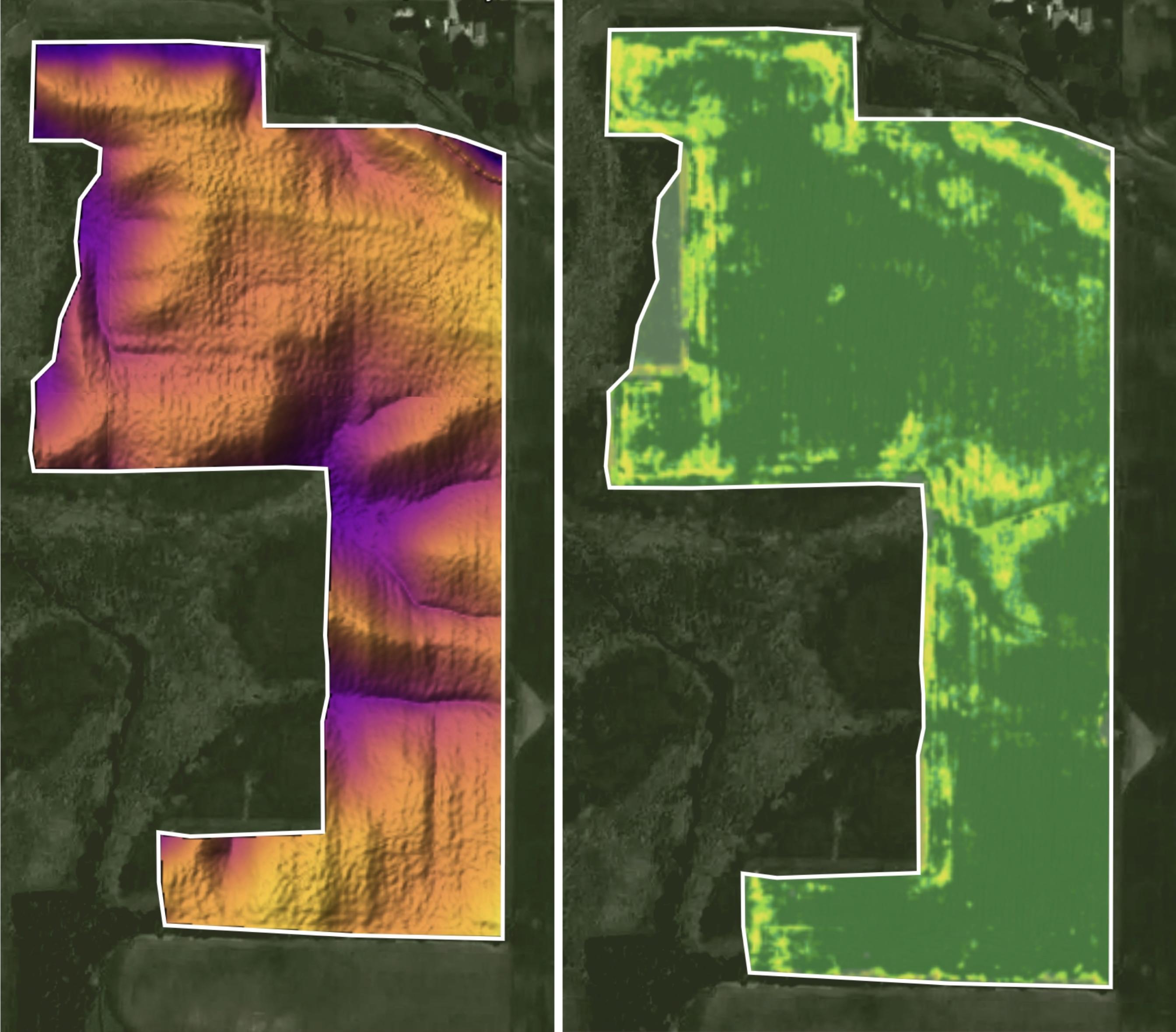
Yield differences appear to be directly correlated to the topography of this field. In the map on the left, the darker the color, the lower the topography.


